Introduction: The Importance of Terminology in Photogrammetry
Welcome to our lesson on the top 10 commonly confused words in photogrammetry. As with any field, having a strong grasp of the terminology is essential. It not only helps in effective communication but also ensures accurate analysis and interpretation of data. In photogrammetry, where precise measurements and 3D reconstructions are involved, the right use of words becomes even more critical. So, let’s dive into these words and clear any confusion you may have.
1. Point Cloud vs. Mesh
Often used interchangeably, point cloud and mesh have distinct meanings in photogrammetry. A point cloud is a collection of 3D points, each representing a specific location in space. It’s like a cloud of dots, capturing the surface of an object. On the other hand, a mesh is a surface representation, where these points are connected to form triangles or polygons. Think of it as a wireframe model. While both are valuable, they serve different purposes. Point clouds are excellent for measurements, while meshes are ideal for visualization and rendering.
2. Orthophoto vs. Oblique Photo
Orthophotos and oblique photos are two types of aerial images, each with its unique characteristics. An orthophoto is an image that has been geometrically corrected, removing any distortions caused by terrain or camera tilt. It’s like a top-down view, offering accurate measurements. On the other hand, an oblique photo is taken at an angle, providing a more detailed view of the object’s sides. It’s great for visual analysis and capturing fine details. Depending on your project requirements, you may need one or both of these image types.
3. GSD vs. Spatial Resolution
GSD, or Ground Sampling Distance, and spatial resolution are terms often used when discussing the quality of aerial imagery. GSD refers to the distance between two consecutive pixel centers on the ground. In simpler terms, it’s the level of detail captured by each pixel. Spatial resolution, on the other hand, is the overall level of detail in an image. It’s determined by factors like sensor capabilities and image processing. While GSD is a more specific measure, spatial resolution gives you a broader understanding of image quality.
4. DEM vs. DSM
In terrain modeling, DEM and DSM are two commonly used terms. DEM stands for Digital Elevation Model, which represents the bare earth’s surface, excluding any objects like buildings or vegetation. It’s like a topographic map, showing the elevation at each point. DSM, on the other hand, stands for Digital Surface Model. It includes all objects on the terrain, like trees and buildings. It’s like a 3D representation of the entire scene. Depending on your analysis, you may need one or both of these models.
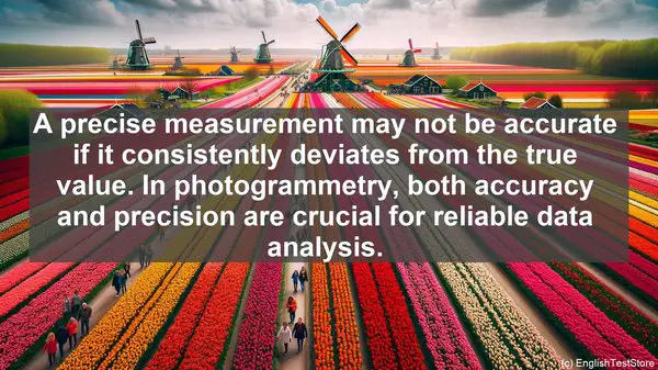
5. Accuracy vs. Precision
Accuracy and precision are often used interchangeably, but they have distinct meanings. Accuracy refers to how close a measurement or result is to the true value. It’s about correctness. Precision, on the other hand, is about consistency and reproducibility. A precise measurement may not be accurate if it consistently deviates from the true value. In photogrammetry, both accuracy and precision are crucial for reliable data analysis.
6. Scale vs. Resolution
Scale and resolution are terms that often come up when discussing maps or images. Scale refers to the ratio of a distance on the map or image to the corresponding distance on the ground. It’s about size. Resolution, on the other hand, is about the level of detail or clarity in an image. It’s about quality. While scale is more related to the overall size, resolution focuses on the finer details. Both are important considerations depending on your project requirements.

7. Nadir vs. Oblique
Nadir and oblique are terms used to describe the angle or direction of an aerial image. Nadir refers to a straight-down view, where the camera is pointing directly towards the ground. It’s like looking straight down from an airplane. Oblique, on the other hand, is at an angle, providing a more tilted view. It’s like looking out of the airplane window. Depending on your project objectives, you may need images from one or both of these perspectives.
8. Bundle Adjustment vs. Georeferencing
Bundle adjustment and georeferencing are two important steps in photogrammetry data processing. Bundle adjustment involves refining the camera positions and orientations to ensure accurate 3D reconstruction. It’s like fine-tuning the camera parameters. Georeferencing, on the other hand, is the process of aligning the photogrammetric data with real-world coordinates. It’s like placing the data on a map. Both are crucial for achieving reliable and geospatially accurate results.
9. Parallax vs. Perspective
Parallax and perspective are terms often encountered when discussing the geometry of images. Parallax refers to the apparent shift in the position of an object when viewed from different angles. It’s like the difference in the object’s position when you close one eye and then the other. Perspective, on the other hand, is about the visual representation of depth and distance in an image. It’s like the convergence of parallel lines in the distance. Both parallax and perspective play important roles in photogrammetry analysis.
10. LiDAR vs. Photogrammetry
LiDAR and photogrammetry are two commonly used techniques for capturing 3D data. LiDAR, which stands for Light Detection and Ranging, uses laser pulses to measure distances and create a 3D point cloud. It’s great for capturing detailed elevation information. Photogrammetry, on the other hand, relies on images and their analysis to create 3D models. It’s versatile and can capture both the surface and texture of objects. Depending on your project requirements, you may choose one or both of these techniques.